

Unlocking the Power of Drone Orthomosaic and 3D Modeling
Precision Mapping
Our drone orthomosaic and 3D modeling technology ensures precise mapping for accurate results.
Efficient Insights
Our technology provides efficient insights through detailed analysis and visualization.
High-Quality Deliverables
We guarantee high-quality deliverables that exceed expectations.
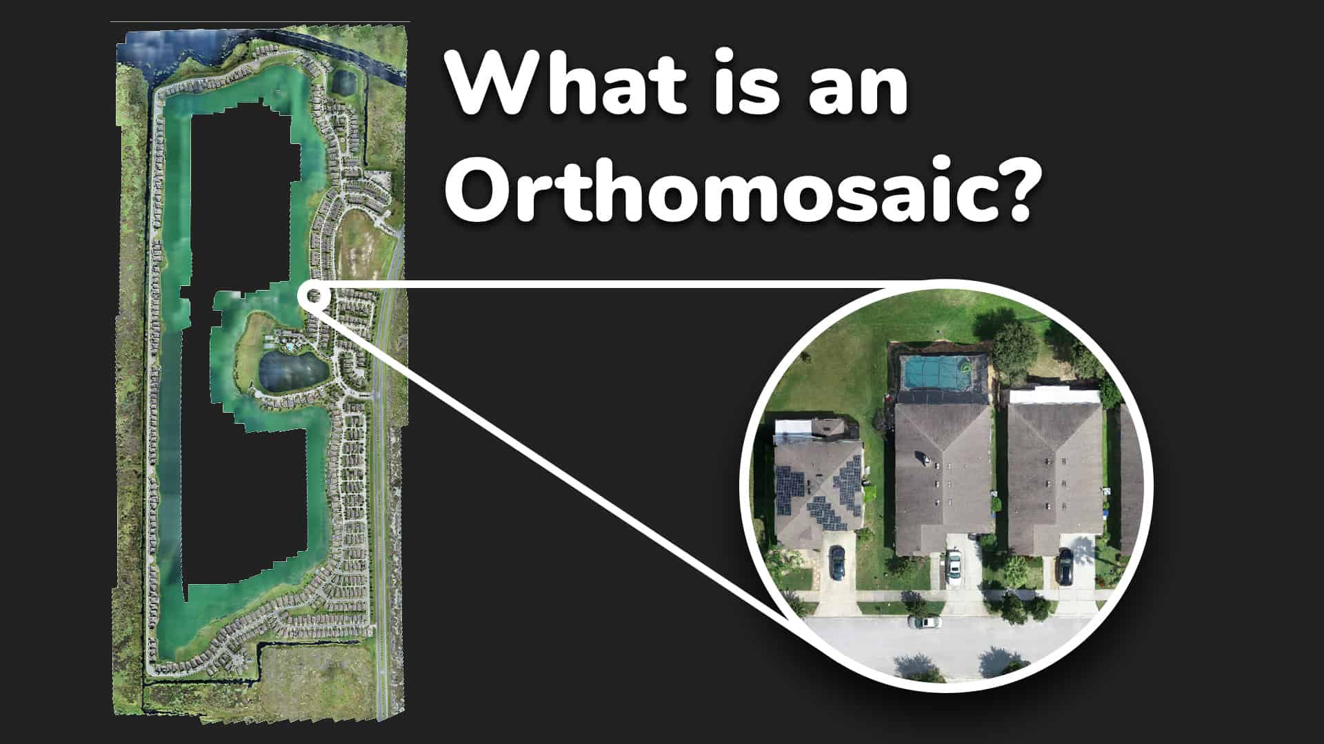
Orthomosiac Mapping
An orthomosaic map is a detailed and accurate aerial image of the Earth’s surface that has been geometrically corrected to remove any distortions and create a uniform scale throughout the image. This image is a result of stitching hundreds of aerial images together to depict the entire map.

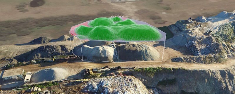
3D Modeling
Drone-based 3D modeling captures aerial data to create detailed representations of landscapes and structures. For construction, it streamlines cut and fill measurements, aiding in precise earthwork planning. In real estate, it offers immersive views for better property assessment and marketing.
Incredible precision. The 3D model provided by this company helped us make crucial decisions with confidence.
Sarah K.
Custom Solutions
We specialize in creating custom solutions tailored to your specific project requirements, ensuring that you receive the most accurate and comprehensive results.